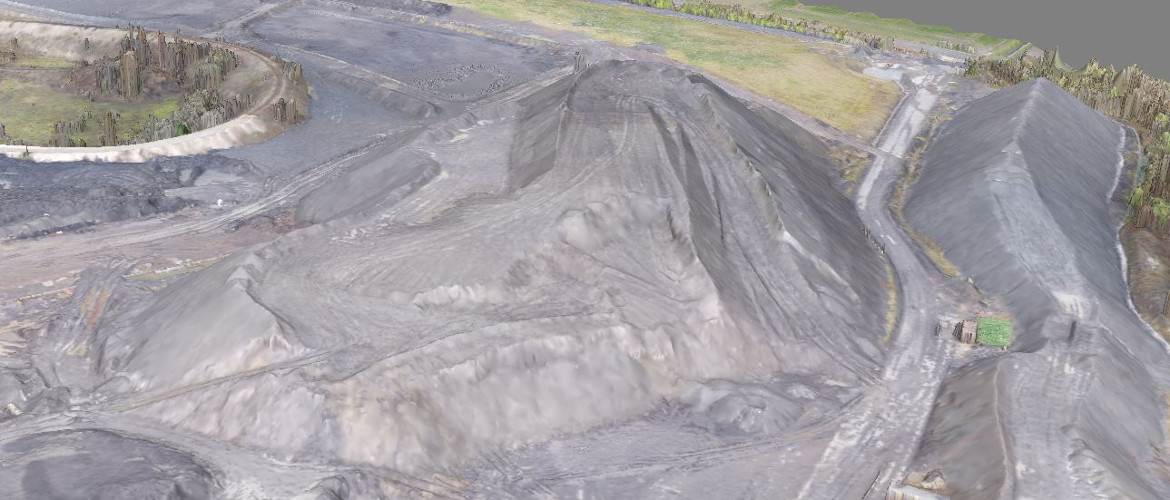
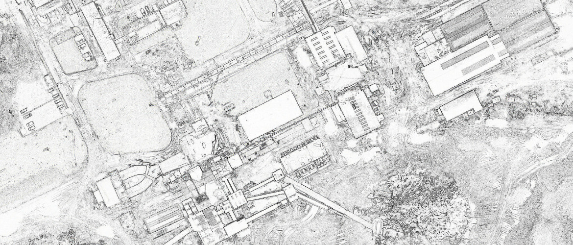
Aerial Mapping Surveys – 3D Mapping & Modelling
In line with our commitment to be at the forefront of the latest technology available, MSUK have purchased a 50% share in Aerial Inspection & Mapping Surveys, AIMS for short.
We now have four CAA approved pilots and three mapping drones.
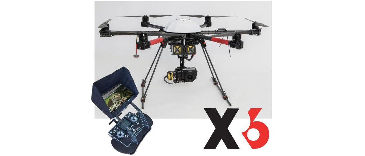
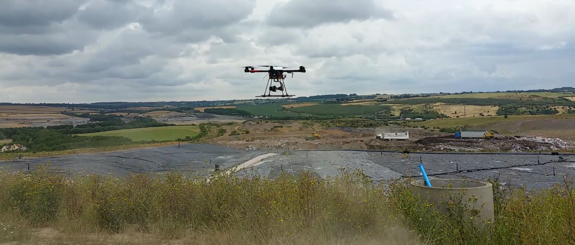
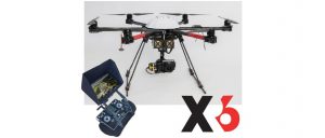
We have an Airborne Robotics XR6 with a Sony NEX 7 digital camera. This is the top end of this type of mapping tool. With this we achieve accuracy of +/- 25mm or better, when compared to control fixed by conventional survey methods.
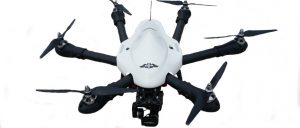
Our Little 6 has been built and designed in house. It is built on a standard Little 6 frame but with all the necessary software to provide fully autonomous flight for mapping operations. It carries a much lighter camera the Go pro Hero Black and with this we achieve accuracy of +/- 35mm or better.
Both are comparable with GPS on individual points but achieve a much greater accuracy over the whole survey area simply because of the much higher level of detail that is picked up.
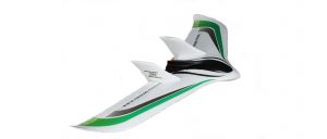
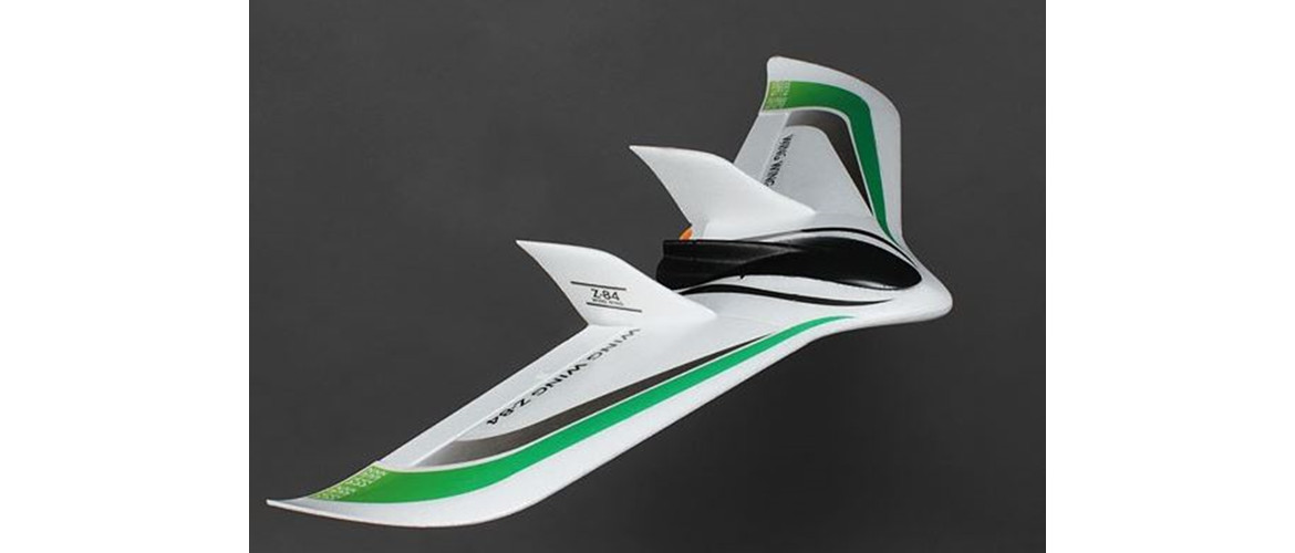
The third option is our Wing Z-84, again designed and built in house. A fully autonomous mapping aircraft but with no gumball to level and steady the downward facing camera the accuracy as with other fixed wing aircraft on the market is not as good as the multi rotor aircraft. Accuracy is around +/- 500 mm but it is much faster . It is useful where cost is an issue as it comes in roughly half the cost of surveys undertaken with our XR6 Multi Rotor.