
How LSS software and Drone / Laser Scanning cloud point data can be used to ensure compliance with Health and Safety legislation.
Mining Surveys (UK) Ltd has offered long range laser scanning services for over a decade. “We have always believed that remote surveying can eliminate or greatly reduce the risks posed to pedestrian surveyors”.
Scenes like this have no place in modern surveying. Thankfully the more enlightened companies are now beginning to explore the alternatives.
Health and Safety at Work etc. Act 1974
- General duties of employers to their employees.
- (1)It shall be the duty of every employer to ensure, so far as is reasonably practicable, the health, safety and welfare at work of all his employees.
- Onus of proving limits of what is practicable
- In any proceedings for an offence under any of the relevant statutory provisions consisting of a failure to comply with a duty or requirement to do something so far as is practicable or so far as is reasonably practicable, or to use the best practicable means to do something, it shall be for the accused to prove (as the case may be) that it was not practicable or not reasonably practicable to do more than was in fact done to satisfy the duty or requirement, or that there was no better practicable means than was in fact used to satisfy the duty or requirement

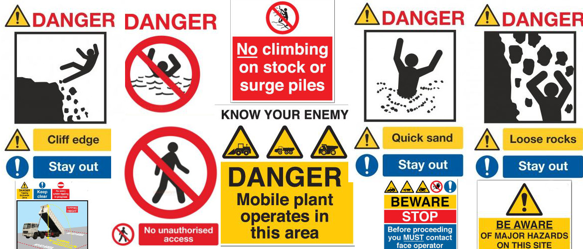
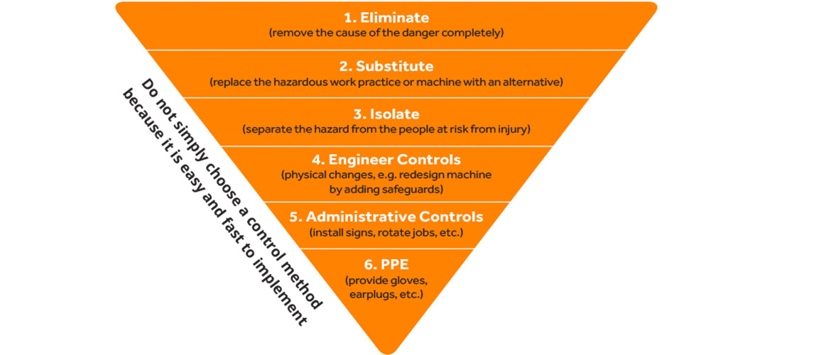
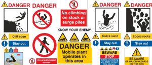
Administrative Controls, like signage and PPE, the last line of defence are no longer sufficient.
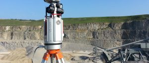
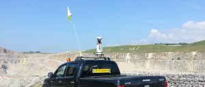
Long Range Laser Scanning, up to 1.4km, eliminates the need for a pedestrian surveyor. Either by setting up well away from danger or by mounting the scanner on a vehicle.
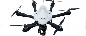
Drones can also be used to reduce the risks.
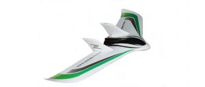
Either Fixed wing or Multi Rotor.
Whichever method you choose the data has to be processed for use in existing software by the end user company. It doesn’t make any sense for a quarrying company to buy specialist software just to enable them to work with the cloud point data produced by these methods.
LSS is utilised by many within the quarrying industry, so why look elsewhere when you need something specific.
MSUK Ltd has been using LSS to highlight deficiencies in edge protection over the past 4 years. Any LSS user can do this.
Before passing on to the LSS user we undertake the post processing of the raw data and for this we do use other specialist software. We provide a clean DTM, free of vegetation, plant and any other erroneous data. If edge protection monitoring is required, we provide two DTM’s one with and one without the edge protection.
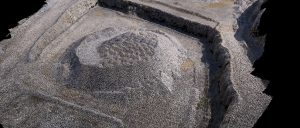
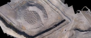
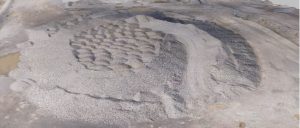
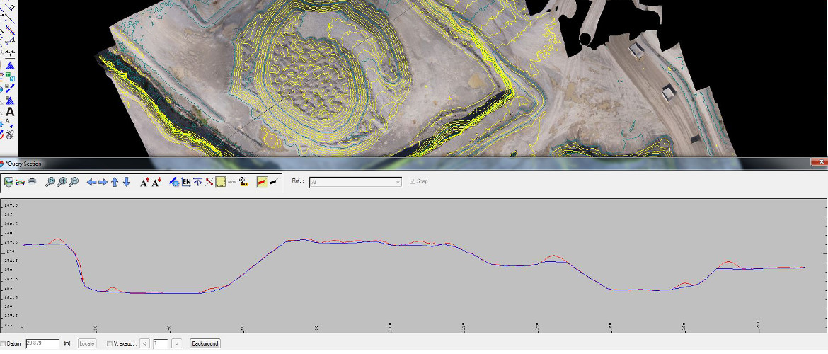
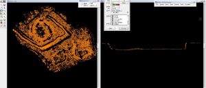
The image above was created using a specialist multi rotor mapping drone. Cloud point data was produced and then filtered to produce a clean DTM. This DTM was then roughly classified to produce a rough ground model and the edge protection. You will see from the image below that the split between ground level and edge protection is not perfect. There are no algorithms that work perfectly every time.
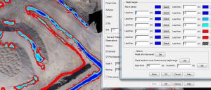
These models are then loaded into other software that allows us to manually, but quickly, step through the data and adjust any anomalies.
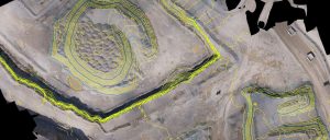
For ease of use and for those who have yet to invest in LSS 3DVision, we thin the data and export for use in LSS as two models.
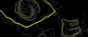
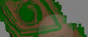
The image above shows the ground levels without safety bunds. We also supply a geo-referenced image which adds clarity without the need to produce string data.
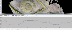
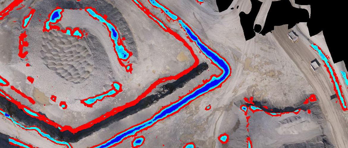
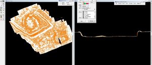
Cutting sections through both models shows us the position of the safety bunds. Creating an isopacyte model is quite simple in LSS and is very effective for monitoring edge protection. Viewing as height bands clearly shows the deficiencies.
Red indicates safety bunds lower than 1m light blue indicates that the bund is lower than 1.5m.
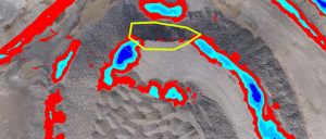
The area edged yellow shows a missing safety bund.
Viewing the 3D model in LSS will confirm any areas where bunds are missing completely.