
Measured Building Surveys by MSUK. Specialists in very large and complex surveys of both land and buildings.
Very few companies, operating in the UK, own hardware and software as technically advanced as ours.
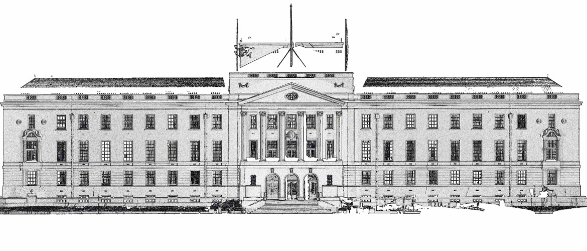
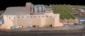
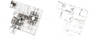
Utilising the latest reflectorless technology, terrestrial laser scanners, drones and total stations with direct reflex, we are able to accurately measure building layouts, elevations and roofs. Internal and external survey control enables us to coordinate floor layouts in 3 dimensions. The cloud point data produced is the base on which all CAD plans are produced.
We are able to produce relatively low cost 3D models of existing and proposed developments
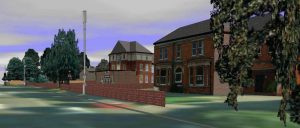
These models have been used at the concept stage to give an impression of the proposed development. They have also been used to outline initial ideas and gain funding.
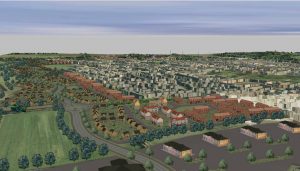
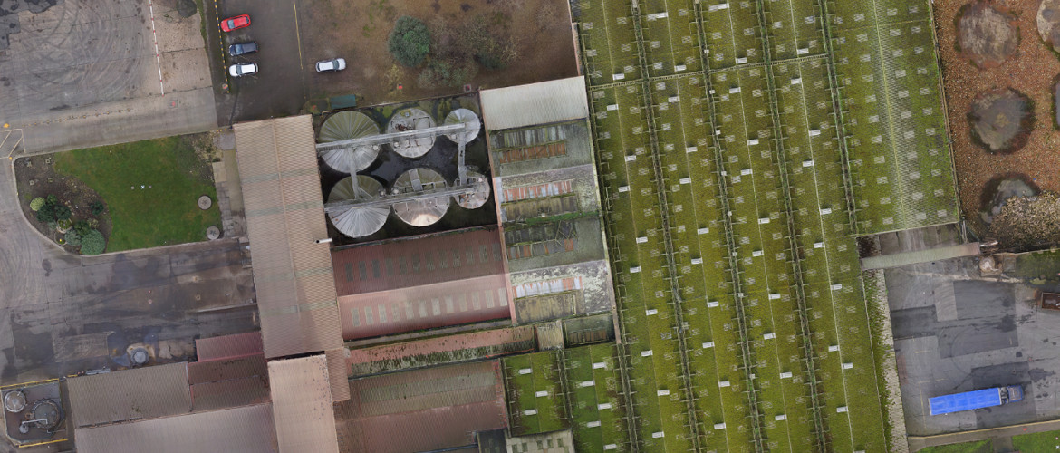
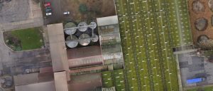
Using our aerial mapping drones we, are able to create 3D fly-throughs of proposed developments and existing site layouts.
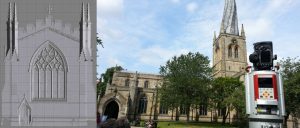
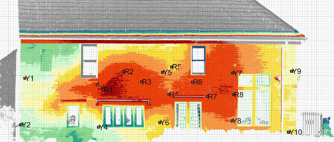
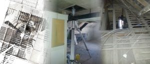
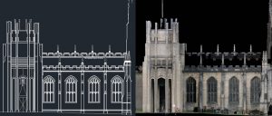
Our laser scanner is unique in its range. It is capable of very high density scans over distances that cannot be achieved by most other scanners.
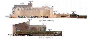
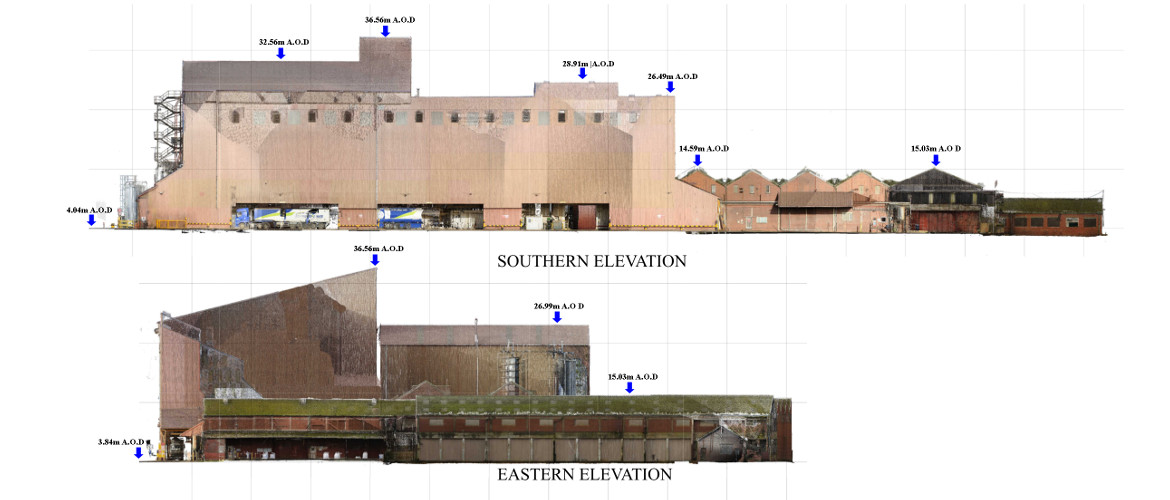
We produce high resolution ortho-rectified images for use in CAD applications. These are a low cost option by comparison to conventional CAD line drawings.
Using a scanner as opposed to conventional survey equipment enables the operator to very quickly survey and record everything. This is very useful when time is limited.
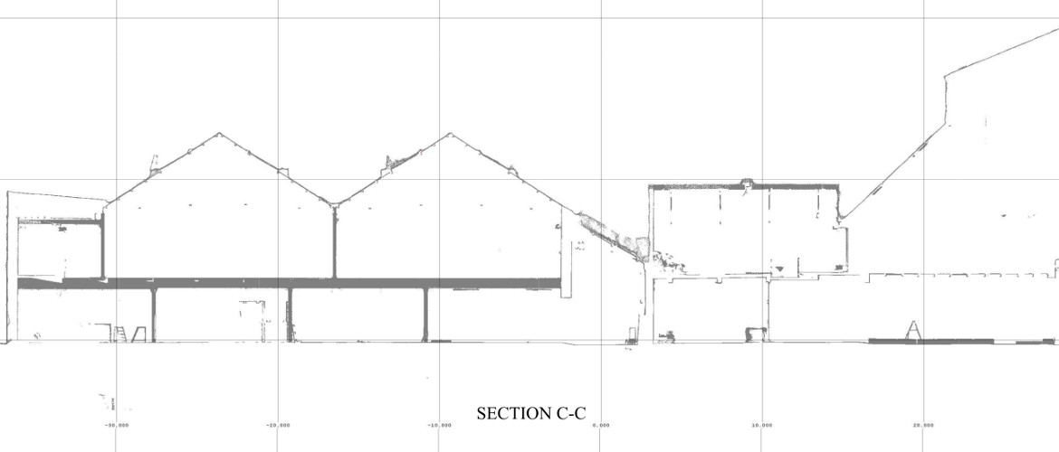
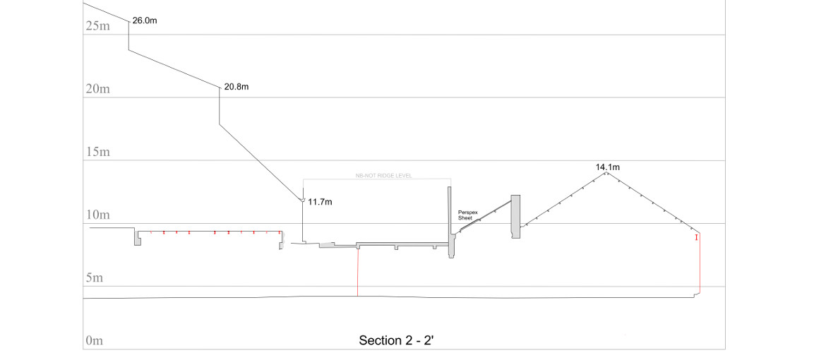
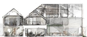
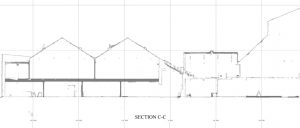
Once the cloud point data has been collected, the client has the opportunity to view slices through the building as opposed to a section, which often gives a better perspective.
Quick low cost sections can be produced as PDF’s or JPEG’s. These can be imported to CAD applications and used without the expense of producing actual CAD drawings.
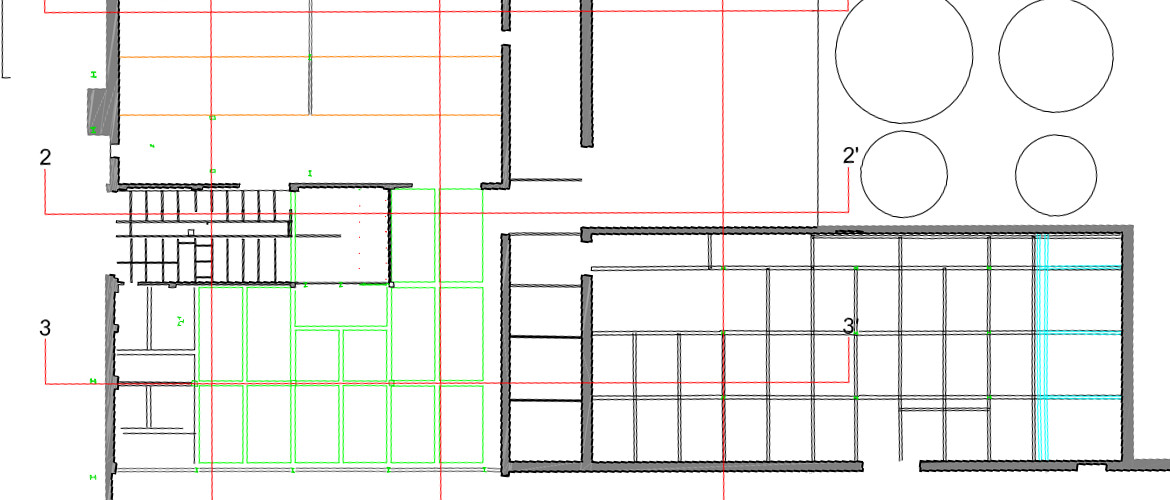
The same can be done for floor layouts.
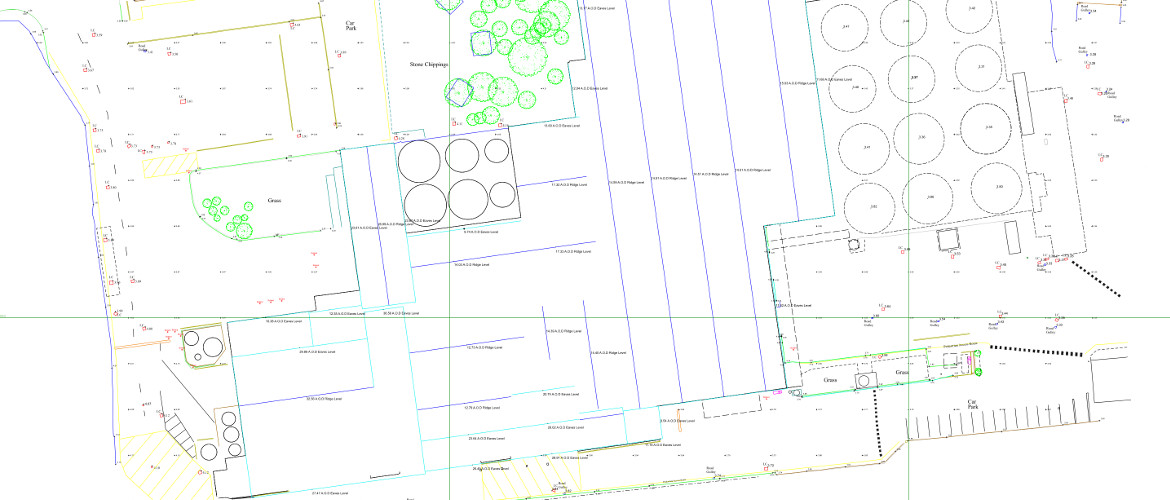
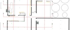
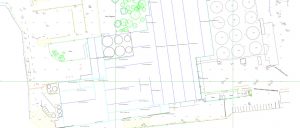
CAD plans can be produced with just the basic details.
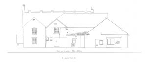
CAD plans can also be 2D or 3D.
On a recent project involving floor layouts on multiple levels as well as the location of structural beams, false roofs, sky lights and services, surveys were completed on each level using an accurate survey control network to produce a highly detailed plan and excellent spatial models.
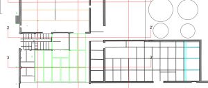
Floor plans can be supplied with varying levels of detail from simple walls, columns and openings to more detailed drawings which include drainage and construction detail, fixed equipment and emission points.
3D Terrain Models can be used give a realistic as-built view of what is really there.
Mining Surveys (UK) Ltd offer a total surveying and mapping solution both Internal and external, above and below ground.
Should you require additional information we are happy to visit and demonstrate the laser scanner and drone in operation.
Contact Us: Mining Surveys (UK) Ltd
3, The Bridge Business Centre, Beresford Way,
Chesterfield, Derbyshire S41 9FG 01246 268444
www.miningsurveys.co.uk